EARLY LEARNING MAP SERIES
Select your Materials
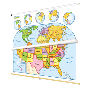
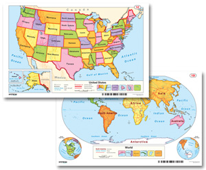
This United States map and world map combine to provide basic geographic information using simple cartographic symbols and conventions. The world map emphasizes continents by making each one a different color; country boundaries are shown as red lines, with each country labeled by name. To keep the presentation simple, longitude and latitude are omitted (except the Equator) and no cities are shown. The U.S. map emphasizes states by color, with each state labeled; capitals and a few of the most major cities are shown. U.S. insets include a locator map, Alaska, and Hawaii; five world-map insets rotate globe views to put different continents front and center. Both maps have shaded relief and legends that explicitly explain how map symbols and conventions work. The maps measure 53″h x 65″w and are mounted together on one heavy-duty metal spring roller with a backboard.
See also:
| Size | |
|---|---|
| Publisher | Nystrom |
| Grade | K–1 |
| ISBN | 9780782510263 |