STUDY PAD MAPS
Connect with a representative to create a custom curriculum for your district.
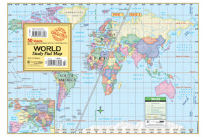
Labeled and unlabeled double-sided full-color political maps (with mountainous areas lightly indicated by shaded relief) equip students for individual study.
The maps show capital cities and time zones as well as latitude and longitude. Water features are always labeled. The world maps show South Sudan. The U.S./World maps have the continental U.S. (with Alaska and Hawaii insets) labeled on one side, the world labeled on the other. The United States maps have the continental U.S. (with Alaska and Hawaii insets) labeled on one side, unlabeled on the other. The World maps have the world labeled on one side, unlabeled on the other (both sides with insets showing a close-up of most of Europe).
This title is part of the series: STUDY PAD MAPS
| Copyright | 2012 |
|---|---|
| Size | 12"h x 18"w |
| Publisher | Universal Map |
| ISBN | 9780762578306 |

