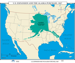
U.S. EXPANSION AND THE ALASKA PURCHASE, 1867
Map on roller with backboard
Connect with a representative to create a custom curriculum for your district.
Focuses on the Russian government’s offer to sell Alaska to the U.S. in 1866. The map superimposes the Alaska Territory upon the contiguous United States to show how big "Seward’s Folly" really was.
This title is part of the series: 19TH CENTURY ROLL-DOWN MAPS
| Size | 46" x 32" |
|---|---|
| Publisher | UniversalMap |

