ALABAMA DESK MAP
30 state desk maps
Alabama, From Mountain Ridges to the Gulf Coast
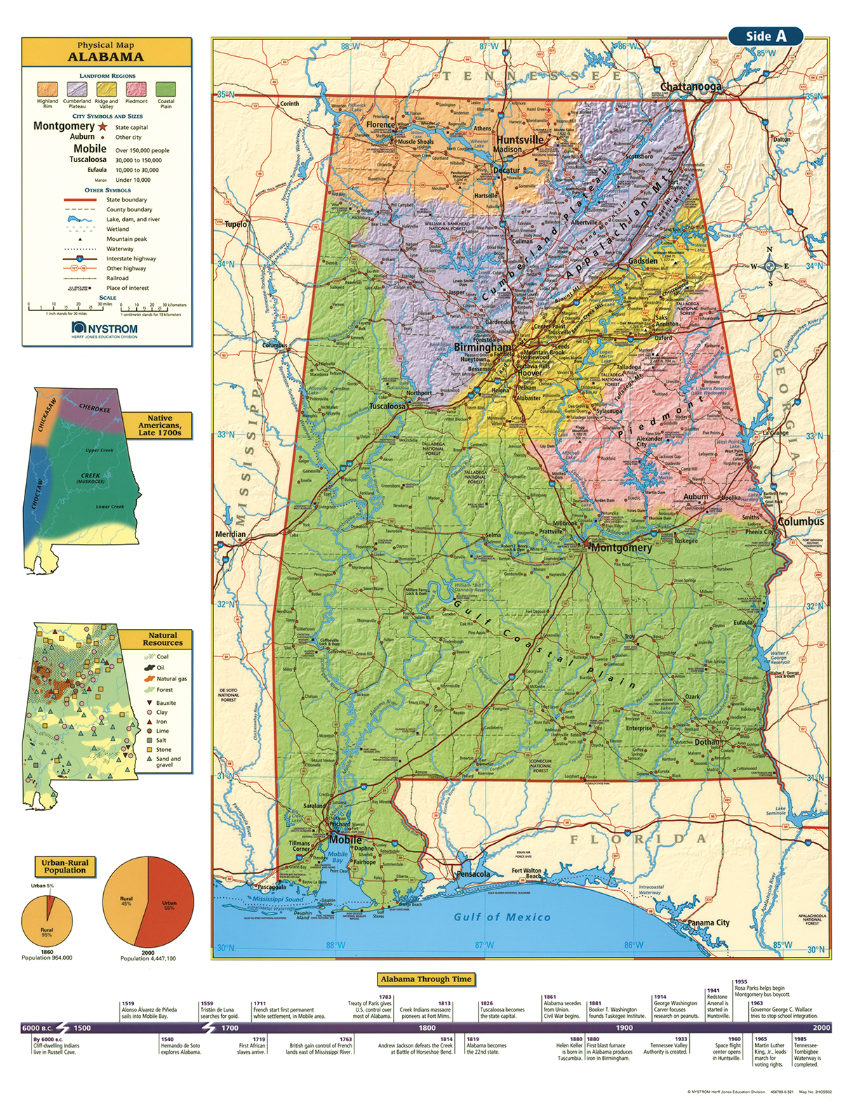
The Alabama Desk Map gives students a colorful, hands-on way to explore the state’s geography. One side features a detailed political map with clearly labeled counties, cities, rivers, highways, and boundaries. The reverse displays a physical map that uses color to express elevation and shaded relief to show Alabama’s varied landforms—from the Appalachian Plateau to the Gulf Coastal Plain.
Thematic insets offer additional layers of context, including population density, land use, precipitation, and more. Subtle design elements ensure that borders and labels never distract from the physical features, keeping the focus on the geography itself. Laminated for durability and markable with wet-erase markers, these maps are sold in packs of 30 and made for repeated classroom use.
Each pack includes a 16-page teacher’s guide with reproducible handouts to support instruction.
Key Features:

