CALIFORNIA DESK MAP
30 state desk maps
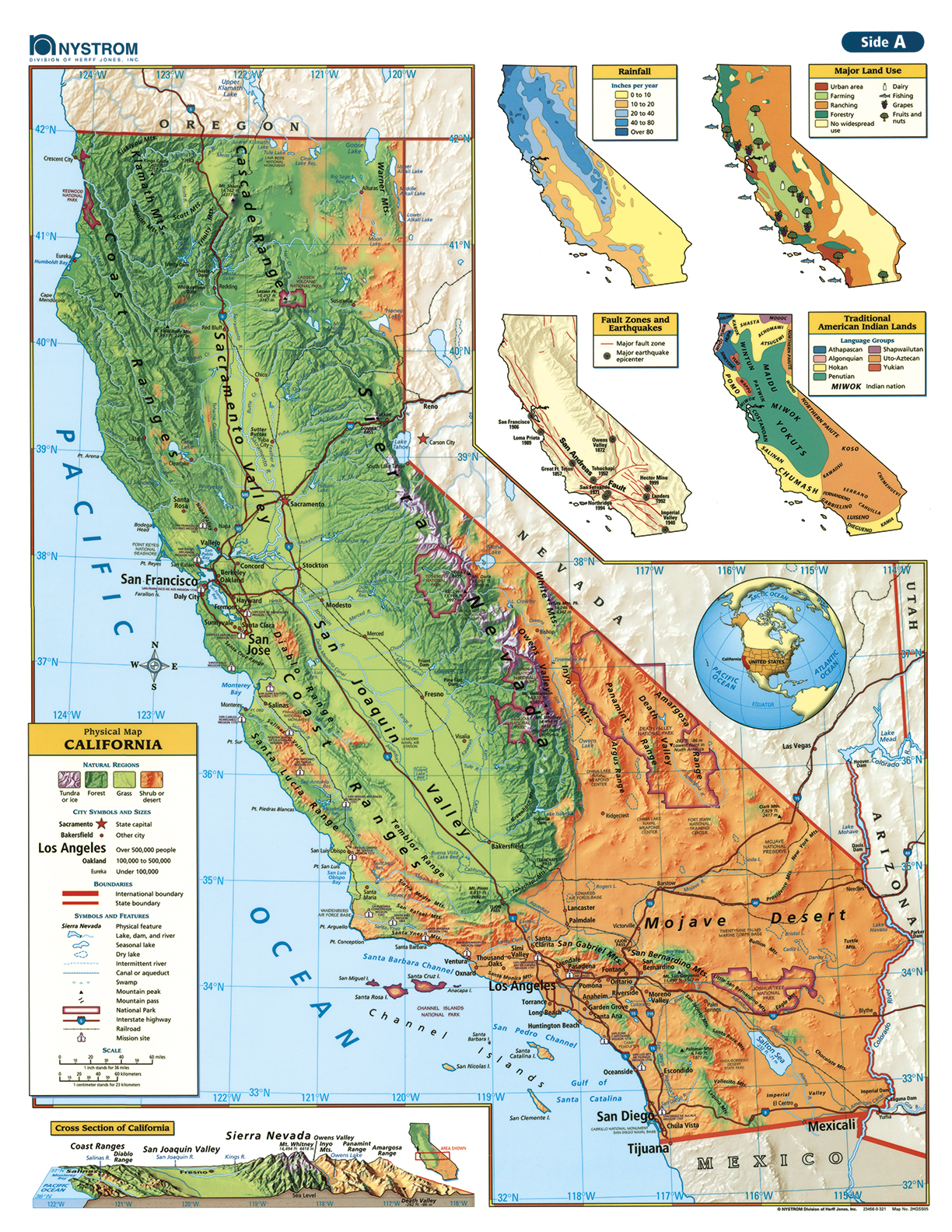
California, From the Redwoods to the Desert
The California Desk Map offers students a hands-on way to explore the Golden State’s varied geography—from coastal ranges and valleys to towering mountains and sprawling deserts. One side features a detailed political map with labeled cities, highways, and physical landmarks. The reverse side offers a map designed to reinforce geography skills in a variety of ways.
Color-coded elevation and shaded relief help students visualize California’s diverse terrain, while thematic insets offer even more to explore—rainfall, fault zones, land use, and Indigenous lands. Laminated and markable with wet-erase markers, the map is designed for repeated classroom use and built to last.
Each set includes 30 maps and a 16-page teacher’s guide with reproducible handouts to support instruction.
Key Features: