
COLORADO DESK MAP
30 state desk maps
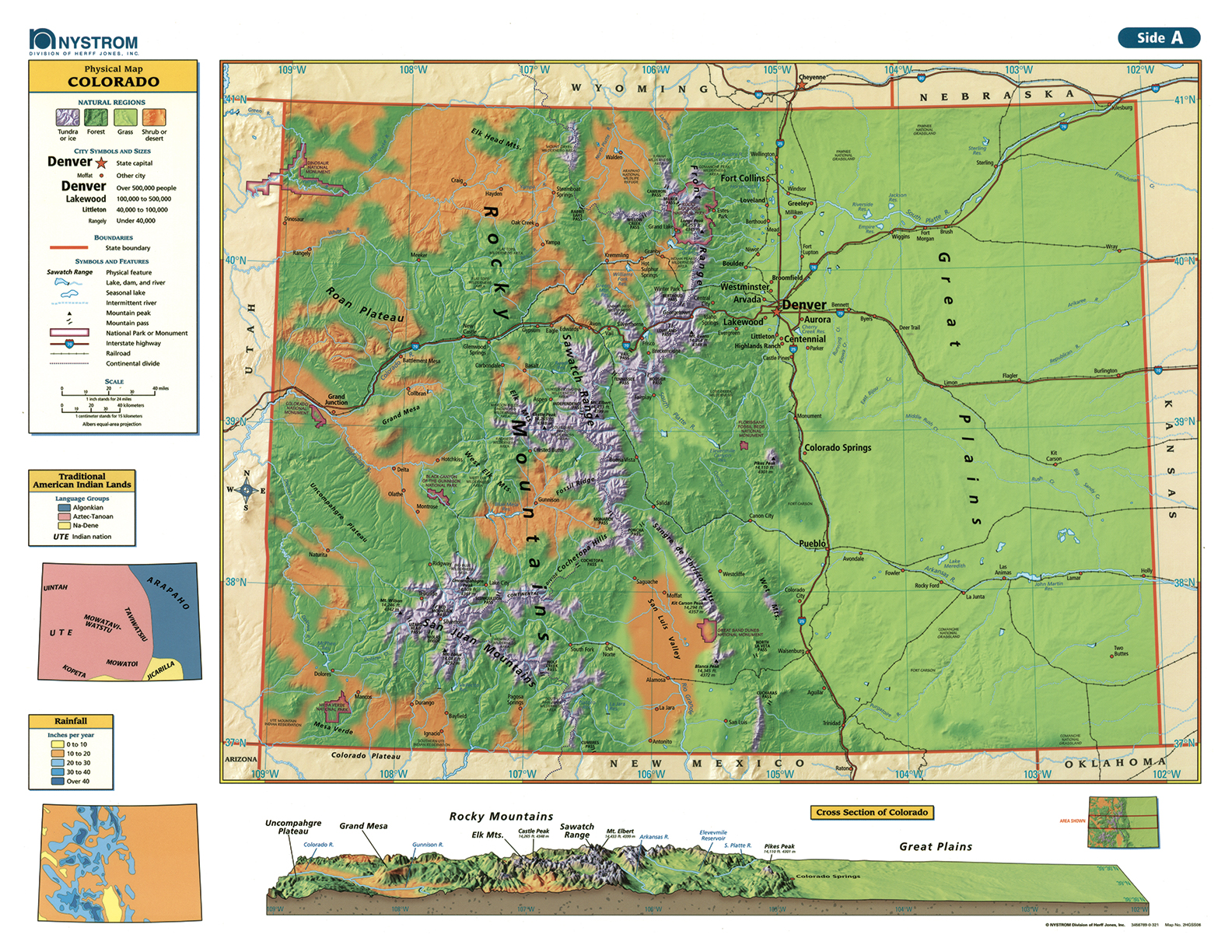
Colorado: A Closer Look at the Centennial State
The Colorado Desk Map gives students a detailed, hands-on way to study the state’s physical and political features. One side shows a full-color political map with counties, major cities, highways, rivers, and landmarks clearly labeled. The reverse side offers a map designed to reinforce geography skills in a variety of ways.
Color-coded elevation and shaded relief reveal Colorado’s varied landscapes, from the Great Plains to the Rocky Mountains. Thematic insets offer even more context with information on population density, land use, precipitation, and traditional Indigenous lands. Printed on durable, laminated stock and markable with wet-erase markers, this desk map is ready for regular classroom use.
Each set includes 30 maps and a 16-page teacher’s guide with reproducible student handouts.
Key Features: