COLORADO
Select your Materials
Connect with a representative to create a custom curriculum for your district.
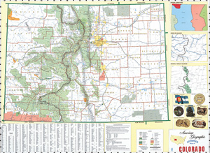
Laminated and mounted on a spring roller designed for hanging on a one-inch map rail (required), this state map shows counties, highways, cities and towns (with alphanumeric gazetteers in the margins), national and state forests and parks, bodies of water, and points of historical interest.
Insets depict items such as the state’s flag, seal, bird, flower, physical subdivisions, rivers, agricultural regions, and population distribution. State/U.S./world combos are available as three maps (the U.S. and world maps measure 65" x 53") on one roller. Markable/wipeable with most wet-erase markers.
| Size | 68" x 50" |
|---|---|
| Publisher | Cram |

