CONNECTICUT
In stock
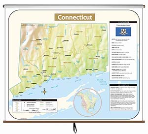
This full-color state map includes shaded-relief topography, county names and borders, major and capital cities, main rivers, and other large bodies of water. It includes insets providing a state flag, a locator map (within North America), a table of statistics, and text with high-interest historical, anecdotal, and geographical information. The single state map comes on a spring roller mountable on a one-inch map rail (already present in many classrooms) or on a backboard. The combo sets comprises one state map plus political maps of the United States and the world, and is also mounted on a spring roller that may require a backboard. The pack of 50 laminated, unlabeled outline maps (8½" x 11") shows rivers, bodies of water, and counties, and include latitude and longitude.
This title is part of the series: CONNECTICUT
| Publisher | Universal Map |
|---|


