DIGITAL ATLAS
Select your Materials
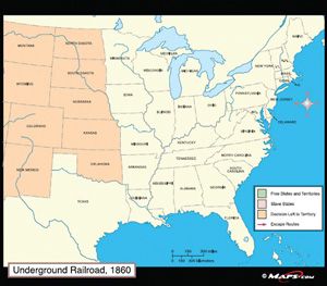
For example, the Underground Railroad map begins with a political map of the U.S. and its territories in 1860, and allows users to turn on and off overlays indicating the status of slavery in each state and territory, as well as common escape routes to the northern U.S., Canada, Mexico, and the Caribbean. Each standards-based lesson can be conducted as a whole-class or individual activity, and provides an outline version of its corresponding map, overview, enduring understanding(s), essential question(s), procedures, background, assessment, extensions, and student handouts.
The Digital Atlas contains the following maps:
- European Exploration of North America, 1000–1682 CE
- The Atlantic Slave Trade Routes, 1500–1619
- French, Spanish, and English Settlements to 1776
- The French and Indian War, 1754–1763
- Ratification of the Constitution, 1787–1790
- Louisiana Purchase: Main Exploration Routes, 1804–1807
- The Missouri Compromise, 1820–1821
- Removal of American Indians, 1830–1838
- Mexican War, 1846–1848
- Status of Slavery in the Territories, 1850–1854
- Underground Railroad, 1860
- Industry and Agriculture in the North and South, 1860
- Secession of Southern States, 1861
- Reconstruction, 1868–1877
- Immigrants to the United States, 1890
- Great Depression, 1929–1939
- The Balance of Power After World War II, 1949–1955
- The Korean War, 1950–1953
- Public School Segregation, 1954
- The Vietnam War, 1969–1975
The Middle School Bundle contains the following maps: Louisiana Purchase, Missouri Compromise, Removal of American Indians, Status of Slavery in the Territories, Underground Railroad.
The High School Bundle contains the following maps: Great Depression, Balance of Power after WWII, Korean War, Public School Segregation, Vietnam War.
| Copyright | 2010 |
|---|---|
| Publisher | Social Studies School Service |
| ISBN | 9781560046158 |


