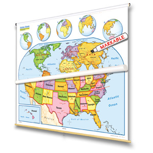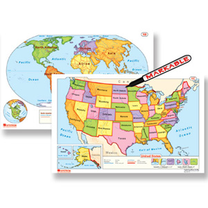
EARLY LEARNER WORLD AND U.S. DESK MAP
Designed with young learners in mind, this double-sided desk map makes it fun and easy to introduce geography to early elementary students. One side features a simplified U.S. map with clearly labeled states and bright colors, while the other showcases a beginner-friendly world map perfect for first-time globe-trotters.
At 11″h x 17″w and laminated for durability, this map is perfectly sized for little hands and built to last in busy classrooms. It’s markable with wet-erase markers, so students can trace borders, circle capitals, and engage with the map—then wipe it clean and do it all again.
Whether you’re teaching directions, continents, or where they live in the world, this desk map helps young learners build spatial awareness and map-reading confidence—all while having fun.
Available as a single map, in packs of 5 or 30 for small group work or class sets, or in a set of 100 for large programs or districtwide use.
Key Features:
This title is part of the series: EARLY LEARNER WORLD AND U.S. DESK MAP
| Publisher | Nystrom |
|---|