ILLINOIS DESK MAP
30 state desk maps
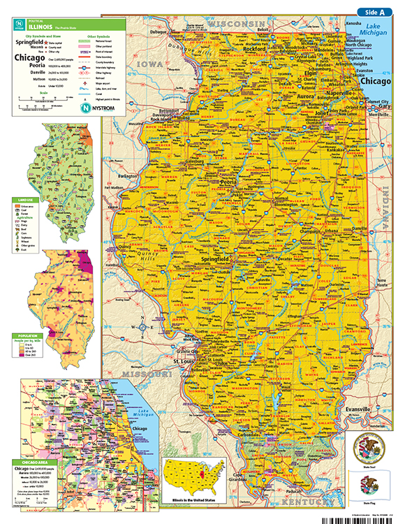
Illinois: Map Skills Meet Midwest Know-How
The Illinois Desk Map gives students a full view of the Land of Lincoln with detailed labeling and clear elevation visuals. One side presents a political map featuring cities, highways, rivers, and county boundaries. The reverse side offers a map designed to reinforce geography skills in a variety of ways.
Color-coded elevation and shaded relief show off Illinois’s physical geography, while thematic insets highlight land use, population, and regional detail—including a zoomed-in look at the Chicago metro area. Laminated and markable with wet-erase markers, this desk map is made for repeated, hands-on use.
Each classroom set includes 30 maps and a 16-page teacher’s guide with reproducible handouts.
Key Features: