INDIANA DESK MAP

30 state desk maps

$420.00

   Order Code: NYS3413D   
Connect with a representative to create a custom curriculum for your district.
This interactive Indiana desk map makes geography approachable and engaging with bold visuals, shaded relief, and real-world data. With space to explore land use, economy, and more, it’s built for active learning at every desk.

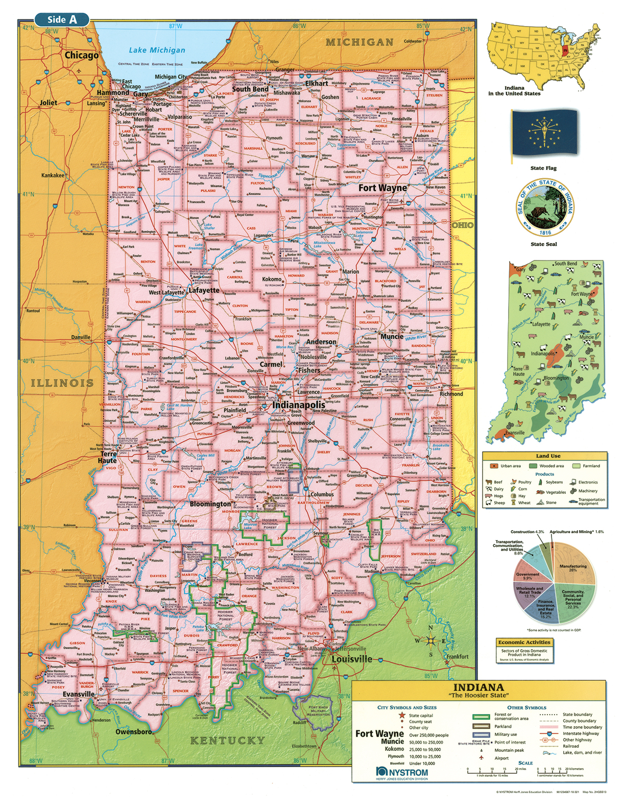
Indiana: A Practical Map for the Crossroads of America

The Indiana Desk Map helps students explore the state’s geography with clarity and hands-on engagement. One side features a detailed political map with labeled counties, cities, rivers, and highways. The reverse side offers a map designed to reinforce geography skills in a variety of ways.

Color-coded elevation and shaded relief highlight landforms and regional variation, while thematic insets dive into land use, conservation, and economic activity. A laminated surface and wet-erase compatibility make these maps classroom-ready and durable enough for daily use.

Each classroom set includes 30 maps and a 16-page teacher’s guide with reproducible student handouts.

Key Features:

  • Double-sided: political map on one side, physical or unlabeled map on the other
  • Color-coded elevation with shaded relief
  • Includes cities, highways, county boundaries, and physical features
  • Thematic insets show land use, conservation, and economic activity
  • Laminated, durable, and markable with wet-erase markers
  • Measures 17″h x 22″w
  • Available in classroom sets of 30
  • Includes a 16-page teacher’s guide with reproducible student handouts
  • Read More