INTERMEDIATE POLITICAL CLASS PACK
Grades 4–5
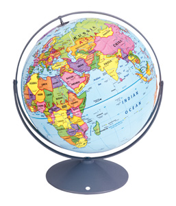
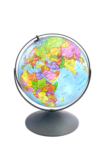
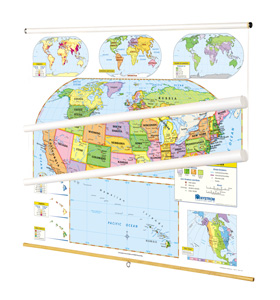
CLASS PACK: 2 maps on 1 roller, backboard, 16" globe in Gyro-disc mount
For intermediate students familiar with cartographic conventions and ready for the main details of geographic information, a markable United States map, a world map, and a globe combine to focus on the political regions of the world by using contrasting colors to make states and countries easy to see. All show capital and major cities (with type size denoting population), and include longitude and latitude. Inset thematic maps show the world’s continents and oceans, north and south polar views, population, and wealth, and the U.S.’s population, time zones, growth through time, and a cross-section elevation profile. Other U.S. map insets show Alaska, Hawaii, and a locator map. Both maps measure 54″h x 65″w and come mounted on one heavy-duty metal spring-roller with a backboard designed for hanging from a map rack or a one-inch map rail (not included). The maps are also available separately. The 16″ 3-D raised-relief globe in the pack comes in a Gyro-disc mount; other mountings and a 12″ size are also available.
| Publisher | Nystrom |
|---|---|
| Grade | 4–5 |
| ISBN | 9780782529173 |