LOUISIANA DESK MAP

30 state desk maps

$420.00

   Order Code: NYS3417D   
Connect with a representative to create a custom curriculum for your district.
This Louisiana desk map makes it easy for students to explore parishes, wetlands, and economic connections all in one place. With shaded relief, thematic insets, and a layout built for student use, it’s a hands-on tool for understanding the geography of this unique coastal state.

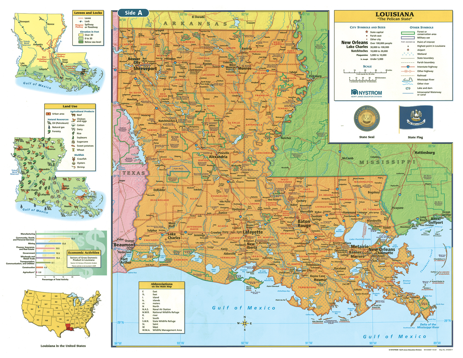
Louisiana: Where Geography Meets Culture and Coastline

The Louisiana Desk Map offers students a dynamic view of the Pelican State’s political and physical geography. One side features a detailed political map with labeled parishes, cities, rivers, highways, and bayous. The reverse side offers a map designed to reinforce geography skills in a variety of ways.

Color-coded elevation and shaded relief help students visualize Louisiana’s low-lying terrain, while thematic insets dive into land use, economic activity, levee systems, and natural resources. The laminated, markable surface is designed for everyday use with wet-erase markers.

Each classroom set includes 30 maps and a 16-page teacher’s guide with reproducible student handouts.

Key Features:

  • Double-sided: political map on one side, physical or unlabeled map on the other
  • Color-coded elevation with shaded relief
  • Includes cities, parishes, highways, waterways, and geographic boundaries
  • Thematic insets highlight land use, levees, economic activities, and agriculture
  • Laminated, durable, and markable with wet-erase markers
  • Measures 17″h x 22″w
  • Available in classroom sets of 30
  • Includes a 16-page teacher’s guide with reproducible student handouts
  • Read More