MAPPING U.S. AND NEW YORK HISTORY — GRADE 7
Discover how geography shaped early U.S. and New York history. This hands-on mapping program helps students connect key themes and events to the places where they happened, building a strong foundation in geographical history. Built around the New York State Social Studies Framework, Mapping U.S. and New York History – Grade 7 is uniquely designed to meet the needs of New York classrooms.
Complete Program Components
Teacher’s Guide
Students gather, organize, and synthesize evidence from texts and visual resources to place milestone events within larger historical trends, visualizing history as they learn new concepts and build skills. The detailed teacher’s guide includes instructions, reproducible handouts, and assessments.
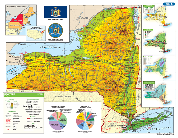
Foldout Activity Map
Foldout and double-sided markable activity maps (from 13″ × 19″ to 39″ × 19″) that show New York, the United States, and the world.
This title is part of the series: MAPPING U.S. AND NEW YORK HISTORY -- GRADE 7
| ISBN | 9780782539868 |
|---|
 Sample pages