MISSOURI DESK MAP

30 state desk maps

$420.00

   Order Code: NYS3424D   
Connect with a representative to create a custom curriculum for your district.
The Missouri desk map gives students a clear, interactive way to explore counties, cities, and key landforms. With shaded relief, population data, and land use insets, it’s an essential tool for teaching state geography with confidence and clarity.

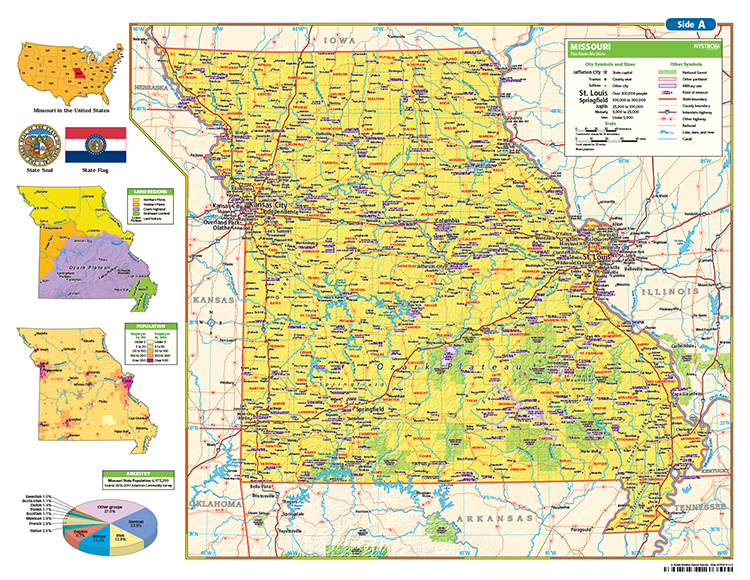
Missouri: A Classroom-Ready View of the Show-Me State

The Missouri Desk Map helps students explore physical and political geography with a hands-on format built for daily use. One side features a labeled political map with counties, cities, rivers, and highways. The reverse side offers a map designed to reinforce geography skills in a variety of ways.

Color-coded elevation and shaded relief give students a clear view of the state’s diverse terrain, while thematic insets provide additional insights into land use, population density, ancestry, and the Ozark Plateau. Laminated and markable with wet-erase markers, this map is designed to support active learning in any classroom setting.

Each classroom set includes 30 maps and a 16-page teacher’s guide with reproducible student handouts.

Key Features:

  • Double-sided: political map on one side, physical or unlabeled map on the other
  • Color-coded elevation with shaded relief
  • Includes cities, counties, highways, rivers, and physical features
  • Thematic insets show land use, population, ancestry, and land regions
  • Laminated, durable, and markable with wet-erase markers
  • Measures 17″h x 22″w
  • Available in classroom sets of 30
  • Includes a 16-page teacher’s guide with reproducible student handouts
  • Read More