NYSTROM U.S./WORLD LAND COVER MAPS
Secondary grades
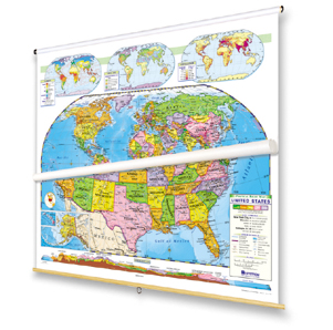
COMPLETE SET: 2 maps on 1 roller with backboard
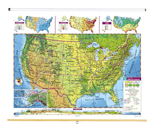
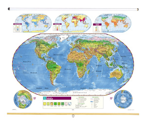
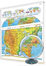
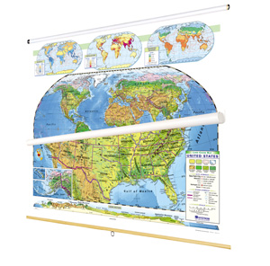
Naturalistic colors mark eight kinds of land cover: cropland, grassland, desert and semi-desert, tundra, glacier, broadleaf and needleleaf forests, and tropical rainforests. Thematic insets show rainfall, population, and growing seasons, and the U.S. map includes a cross-sectional elevation profile. Boundary lines mark out labeled states or countries, capital and major cities are shown (with populations indicated by type size and symbol size), shaded relief indicates the locations of terrestrial and subsea mountain ranges, and latitude and longitude are delineated. Each map measures 53"h x 65"w. The maps come mounted on a heavy-duty metal spring roller with a backboard.
See also:
| Size | 53"h x 65"w |
|---|---|
| Publisher | Nystrom |
| ISBN | 9780782510362 |