OKLAHOMA DESK MAP

30 state desk maps

$420.00

   Order Code: NYS3435D    ISBN : 9780782529296
Connect with a representative to create a custom curriculum for your district.
This Oklahoma desk map blends bold visuals with rich data on land use, agriculture, and geography. With shaded relief, thematic insets, and a durable design, it’s a smart pick for classrooms that want to dig into state-level learning.

Oklahoma: A Visual Guide to the Sooner State

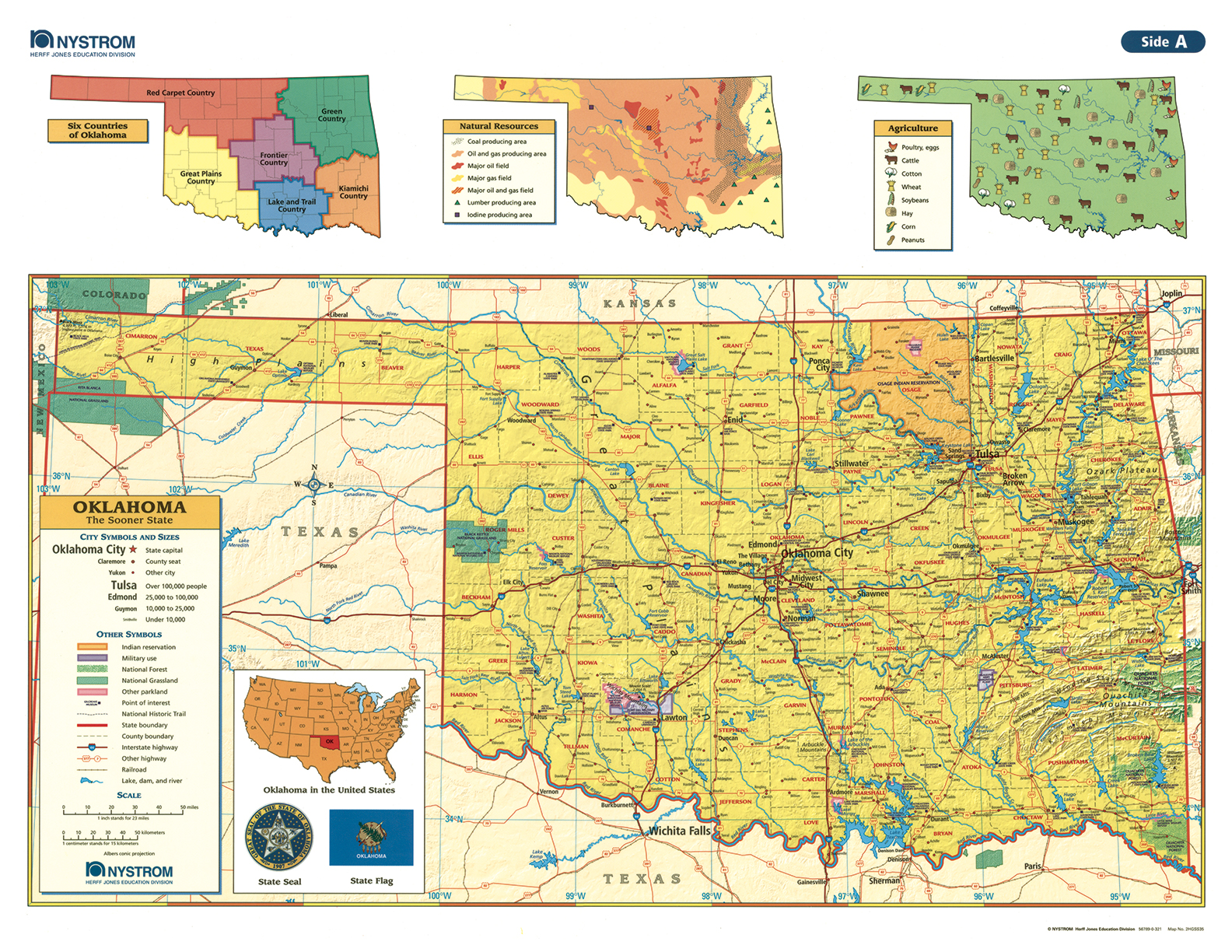
The Oklahoma Desk Map equips students with a clear, colorful view of the state’s geography—from major cities to resource-rich land and agricultural regions. One side features a labeled political map with counties, cities, highways, and rivers. The reverse side offers a map designed to reinforce geography skills in a variety of ways.

Color-coded elevation and shaded relief reveal Oklahoma’s varied terrain, while thematic insets explore agriculture, natural resources, and the state’s six regional “countries.” The laminated surface is durable and markable with wet-erase markers, making this map a practical, reusable classroom staple.

Each classroom set includes 30 maps and a 16-page teacher’s guide with reproducible student handouts.

Key Features:

  • Double-sided: political map on one side, physical or unlabeled map on the other
  • Color-coded elevation with shaded relief
  • Includes labeled cities, counties, rivers, highways, and landforms
  • Thematic insets highlight agriculture, natural resources, and regional divisions
  • Laminated, durable, and markable with wet-erase markers
  • Measures 17″h x 22″w
  • Available in classroom sets of 30
  • Includes a 16-page teacher’s guide with reproducible student handouts
  • Read More
    ISBN

    9780782529296