

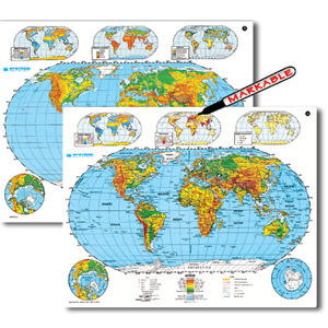
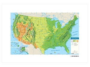
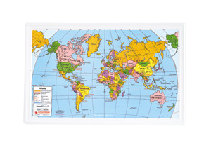
PHYSICAL-POLITICAL WORLD AND U.S. DESK MAP
Select your Materials
Teach U.S. and World Geography with One Interactive Map!
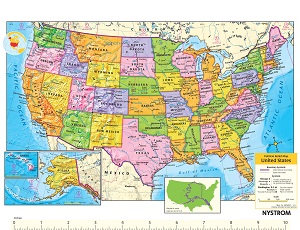
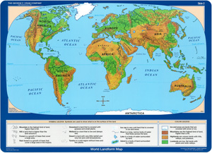
This double-sided Physical-Political World and U.S. Desk Map is the go-to supplement for helping students explore the big picture—at both the national and global level. One side features a physical-political map of the United States with shaded relief and labeled states. Flip it over to find a colorful map of the world with elevation clearly indicated by color and shading.
Designed for active learning, this map highlights key features like boundary lines between labeled countries and states, major and capital cities, landforms, water features, and latitude and longitude. Insets on both sides provide bonus content including population, land use, and vegetation—ideal for helping students connect geographic concepts to real-world data.
Laminated and markable with wet-erase markers, this desk map is built to handle repeated classroom use. Use it during guided lessons, independent practice, or map skill warm-ups—then wipe it clean and use it again. Available as a single map or in sets of 5, 30, or 100 to fit classrooms of every size.
Key Features:
| Size | |
|---|---|
| Publisher | Nystrom |
| ISBN | 9780884633730 |
Related products
-
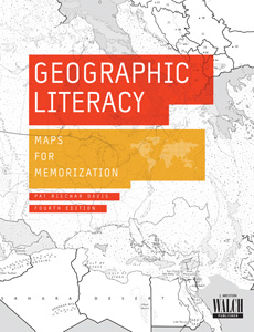
GEOGRAPHIC LITERACY
$29.95 Add to cart -
SCULPTURAL RELIEF WORLD DESK MAP
$39.00 Add to cart -
3-D RAISED-RELIEF PHYSICAL U.S. DESK MAP
$35.00 Add to cart -
3-D RAISED-RELIEF POLITICAL WORLD DESK MAP
$32.00 Add to cart -
NOTEBOOK MAP
$99.00 Add to cart -
UNITED STATES AND WORLD LANDFORM MAP
$102.00 Add to cart