THE NYSTROM ATLAS FOR NEW YORK CITY
Connect with a representative to create a custom curriculum for your district.
The Nystrom Atlas for New York City and Student Activities book help students explore their community and the five boroughs.
They’re also supported by the NYCDOE K–8: Passport to Social Studies, and NYSTAL approved!
Features:
- Explains the basics of interpreting maps and globes
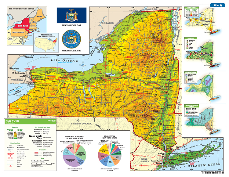
- Locates NYC in the world, in the U.S., in the Northeast region, and in New York state
- Gives a survey of New York state’s urban and rural areas
- Uses the state map to introduce alphanumeric map grids
- Shows the city’s neighborhoods and suburbs, transportation networks, cultural assets, government, and its changes over time
- Available for purchase on FAMIS/SHOPDOE
This atlas is most widely used in grade 2. Index. Glossary. 8½" x 11". 48 pages. 2017 updated edition.
Also available:
- STUDENT ACTIVITIES. Reproducible handouts supported by detailed teaching directions guide the way to close inspection and thoughtful analysis of every two-page spread in the atlas. Answer keys where appropriate.8½" x 11". 93 pages.
- ATLAS PACK. Comes in two versions: one with 30 atlases and the student activity book, and another that adds a five-year atlas ebook subscription with online activities (license for one teacher and all of that teacher’s students).
This title is part of the series: THE NYSTROM ATLAS FOR NEW YORK CITY
| Publisher | Nystrom |
|---|