UTAH DESK MAP

30 state desk maps

$420.00

   Order Code: NYS3443D   
Connect with a representative to create a custom curriculum for your district.
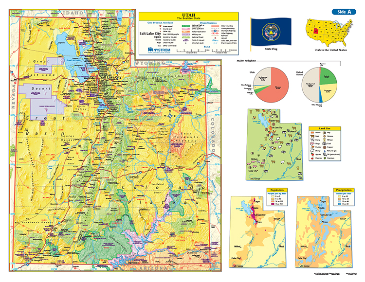
This Utah desk map gives students a bold, colorful way to explore the state’s geography and demographics. With mountains, deserts, and city hubs all clearly marked, it’s an interactive essential for teaching the Beehive State.

Utah: A Hands-On Look at the Beehive State

The Utah Desk Map gives students an engaging, detailed view of the state’s geography—from the Wasatch Range to the red rock deserts of the south. One side features a labeled political map with cities, counties, rivers, highways, and physical features. The reverse side offers a map designed to reinforce geography skills in a variety of ways.

Color-coded elevation and shaded relief showcase Utah’s dramatic landscape, while thematic insets dive into land use, precipitation, population distribution, and religion. Laminated for durability and markable with wet-erase markers, this double-sided desk map is ready for everyday classroom use.

Each classroom set includes 30 maps and a 16-page teacher’s guide with reproducible student handouts.

Key Features:

  • Double-sided: political map on one side, physical or unlabeled map on the other
  • Color-coded elevation with shaded relief
  • Includes labeled cities, counties, highways, landforms, and rivers
  • Thematic insets highlight land use, population, religion, and climate patterns
  • Laminated, durable, and markable with wet-erase markers
  • Measures 17″h x 22″w
  • Available in classroom sets of 30
  • Includes a 16-page teacher’s guide with reproducible student handouts
  • Read More