VIRGINIA DESK MAP

30 state desk maps

$420.00

   Order Code: NYS3445D   
Connect with a representative to create a custom curriculum for your district.
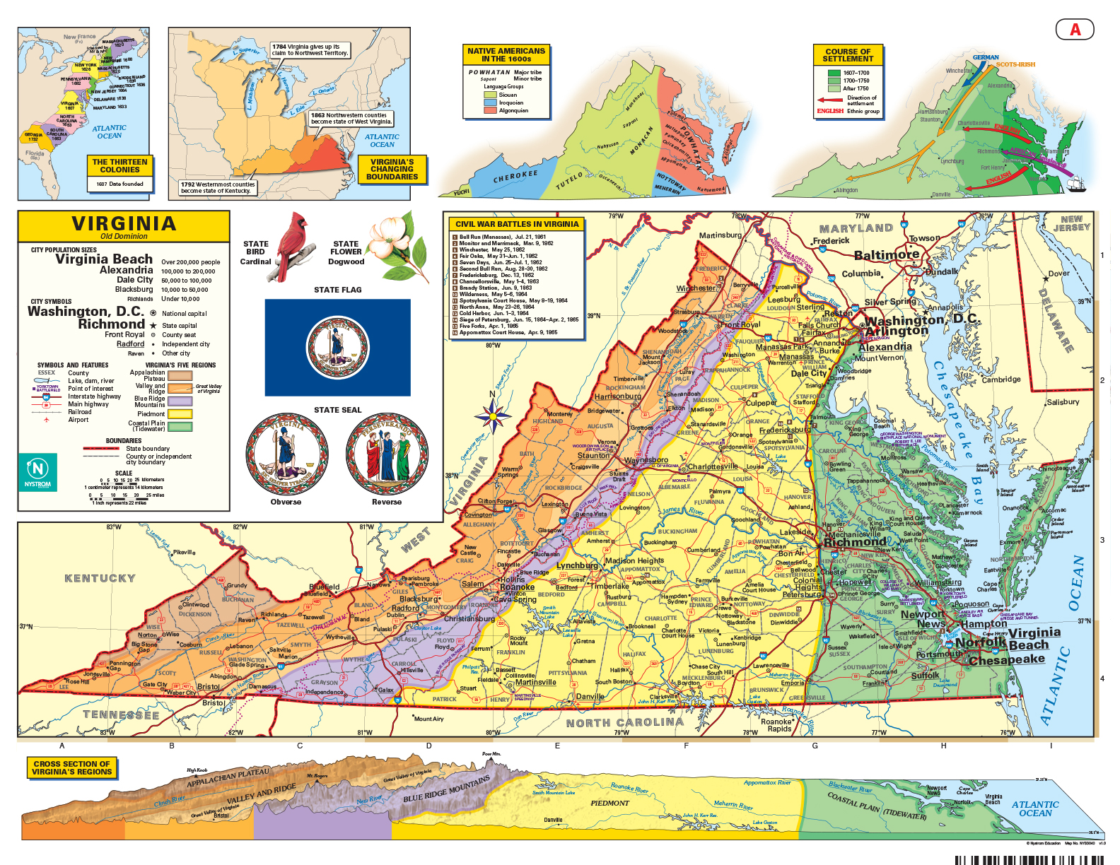
This Virginia desk map gives students a full view of the state’s landscapes, landmarks, and layered history. With detailed labeling and thematic insets, it’s your go-to map for teaching everything from the Piedmont to the Peninsula.

Virginia: A Classroom Map That Covers Every Region and Ridge

The Virginia Desk Map helps students explore the state’s physical and political geography in a hands-on, easy-to-use format. One side features a labeled political map showing cities, counties, highways, and landforms. The reverse side offers a map designed to reinforce geography skills in a variety of ways.

Color-coded elevation and shaded relief bring Virginia’s five geographic regions into focus, while thematic insets add depth with cross sections, settlement patterns, Indigenous groups, and Civil War battle locations. Laminated and markable with wet-erase markers, this double-sided map is built for active classroom use.

Each classroom set includes 30 maps and a 16-page teacher’s guide with reproducible student handouts.

Key Features:

  • Double-sided: political map on one side, physical or unlabeled map on the other
  • Color-coded elevation with shaded relief
  • Includes cities, counties, highways, rivers, and physical features
  • Thematic insets highlight regions, settlement, Native Americans, and historical events
  • Laminated, durable, and markable with wet-erase markers
  • Measures 17″h x 22″w
  • Available in classroom sets of 30
  • Includes a 16-page teacher’s guide with reproducible student handouts
  • Read More