texas

Texas

Texas educators have needs that are unique and different from other states. That’s why we made this page just for you and your needs as a social studies professional.

Events
January 25, 2024
West Texas SS Congress Conference (Region 19)
Session 1
Holding History: Introducing Primary Sources in the Elementary Classroom
Session 2
Seeing is Believing: Developing Visual Literacy Skills
Session 3
Fostering Student Inquiry with a Primary Source Mystery
January 27, 2024
Region 4 SS Conference
Session 1
Seeing Is Believing: Developing Visual Literacy Skills to Support Student Learning
February 15-16, 2024
Texas Social Studies Supervisors Assoc Conference
June 19, 2024
Region 16 Conference

Learn more about engaging products made specifically for your state.

THE NYSTROM ATLAS OF TEXAS HISTORY

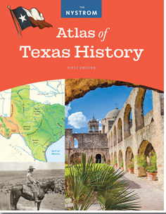
This first edition of The Nystrom Atlas of Texas History uses various approaches to teach about Texas in a new and exciting way by incorporating graphs, maps, charts, and images. The first two units cover political Texas, physical Texas, geographic diversity, and natural features. The subsequent nine units cover Texas history from first inhabitants to modern Texas. Correlated to TEKS standards.

TEXAS: Decision Making in U.S. History

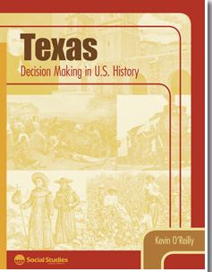
Involving students in real historical problems that convey powerful lessons about Texas history, these thought-provoking activities combine core content with valuable practice in decision making, critical thinking, and understanding multiple perspectives.

TEXAS DESK MAP

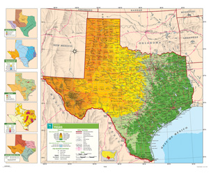
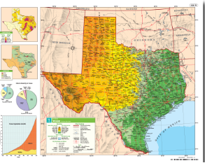
Packs of 30 double-sided, laminated, markable desk maps give students a detailed look at their state. Includes a detailed political map on one side and either a physical or unlabeled map on the other. All maps include a variety of thematic insets showing population density, land use, annual precipitation and more. Desk maps come with a 16-page teacher’s guide with reproducible handout.
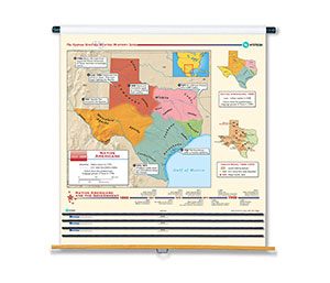
TEXAS SHADED RELIEF MAP

This full-color state map includes shaded-relief topography, county names and borders, major and capital cities, main rivers, and other large bodies of water. It includes insets providing a state flag, a locator map (within North America), a table of statistics, and text with high-interest historical, anecdotal, and geographical information.

TEXAS STATE MAP

Laminated and mounted on a spring roller designed for hanging on a one-inch map rail (required), this state map shows counties, highways, cities and towns (with alphanumeric gazetteers in the margins), national and state forests and parks, bodies of water, and points of historical interest.

Discover More Professional Learning Opportunities

Social Studies School Service utilizes district goals and data to personalize supports, and to develop and facilitate professional learning opportunities that build capacity around instructional practice, resource implementation, teacher transfer, and social studies leaderships.

Meet your state curriculum specialist
Summer Carter
Texas Curriculum Specialist
As a former teacher (and certified history nerd), Summer is devoted to supporting educators and students alike. Based in Fort Worth with her teenage son, Summer collaborates with district administrators and teachers, providing top-tier instructional resources. When she's not enriching classrooms, you'll find her strumming her guitar or making a difference through community volunteering.
Meet your state curriculum specialist
Jason Ihlenfeld
Texas Curriculum Specialist
Jason first moved to Texas in 2000 taking his first teaching position as a 7th grade Texas History Teacher.  After teaching both Texas and US History in middle school, he took a job teaching World Geography and 11th grade US History.  In 2008 Jason began his career in Educational Publishing with Nystrom working in the San Antonio and Corpus Christi territory before taking an Area Manager position in 2013.  In 2014 Jason became the curriculum specialist for the Eastern half of Texas with Social Studies School Service where he is currently still serving.