NYSTROM POLITICAL-RELIEF CONTINENTS MAP SETS
Take your students on a world tour with the Nystrom Political-Relief Continents Map Sets. These maps offer a clear view of both political boundaries and natural landscapes, helping students explore the relationship between geography and global affairs. From Europe’s bustling capitals to the mountain ranges of Asia, these maps offer an exciting way to teach how borders and terrain shape the world.
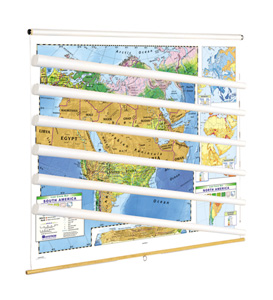
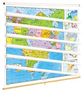
Printed on durable, tear-resistant stock, these 42″h x 54″w maps are designed for everyday classroom use. They’re markable with wet-erase markers, making it easy for students to engage with the content by tracing borders, highlighting countries, or pinpointing key landmarks. Each map comes mounted on spring rollers attached to backboards, perfect for hanging from a map rack or a one-inch map rail (required). For even more flexibility, you can choose individual roll-down maps or opt for flip charts on sturdy tripods.
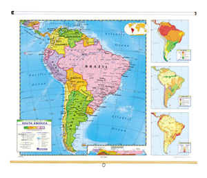
These maps offer a dual focus on political and relief features, showcasing countries, capital cities, major terrain, and physical landmarks. With shaded relief to highlight mountain ranges and labeled cities sized by population, they give your students a comprehensive understanding of each continent’s political and physical landscape. Whether it’s Europe, Asia, or Africa, students will be able to connect the dots between geography and global dynamics in a hands-on, visual way.
Engage your students with maps that do more than hang on the wall—they become an interactive tool for understanding the world. Whether you choose roll-down maps or flip charts, this set is built to enhance your geography lessons and keep students excited about learning.
Contents:
- Set of five: North America, South America, Europe, Asia, Africa
- Set of six: North America, South America, Europe, Asia, Africa, Australia
This title is part of the series: NYSTROM POLITICAL-RELIEF CONTINENTS MAP SETS
| Size | 65"w x 53"h |
|---|---|
| Publisher | Nystrom |