POLITICAL RELIEF CLASS PACK
Secondary grades
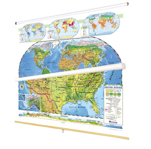
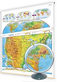
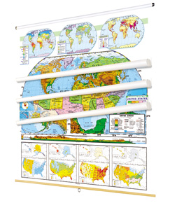
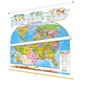
CLASS PACK: 2 maps on 1 roller, backboard, 16" globe in Gyro-disc mount
Contrasting colors make countries and U.S. states immediately visible, and both maps show latitude and longitude as well as capital and major cities (with type and symbol size denoting population). Both maps also offer insets showing population, climate, and land use, and the U.S. map includes insets of Alaska and Hawaii, a locator map, and a cross-continent, cross-section elevation profile.
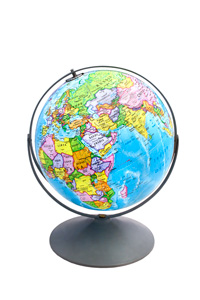
Both maps measure 54″h x 65″w and come mounted on one heavy-duty metal spring-roller with a backboard designed for hanging from a map rack or a one-inch map rail (not included). The maps are also available separately. The 16″ 3-D raised-relief globe in the pack comes in a Gyro-disc mount; other mountings and a 12″ size are also available.
Also available: political relief continents and regions and a dual scupltural and political relief set.
| Publisher | Nystrom |
|---|---|
| ISBN | 9780782529197 |