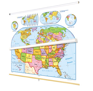
READINESS WORLD AND U.S. DESK MAP
Big Adventures for Early Explorers!
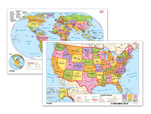
Designed especially for young geographers, the Readiness World and U.S. Desk Map helps K–3 students start building map skills without feeling overwhelmed. One side features a simplified map of the world; the other, a colorful view of the United States—each designed to spark curiosity while supporting early social studies learning.
Countries and states are color-coded for easy distinction, and major cities, landforms, and water features are clearly labeled. Shaded-relief mountain ranges add depth, while latitude and longitude lines provide an early introduction to global positioning—without needing a GPS!
Printed on durable, laminated stock and markable with wet-erase markers, this 11″h x 17″w map is ready for all kinds of classroom adventures. Whether tracing rivers or circling capitals, students can interact with the content again and again. Available as a single map or in sets of 5, 30, or 100.
Key Features:
This title is part of the series: READINESS WORLD AND U.S. DESK MAP
| Publisher | Nystrom |
|---|---|
| Grade | K–3 |
| ISBN | 9780782506983 |