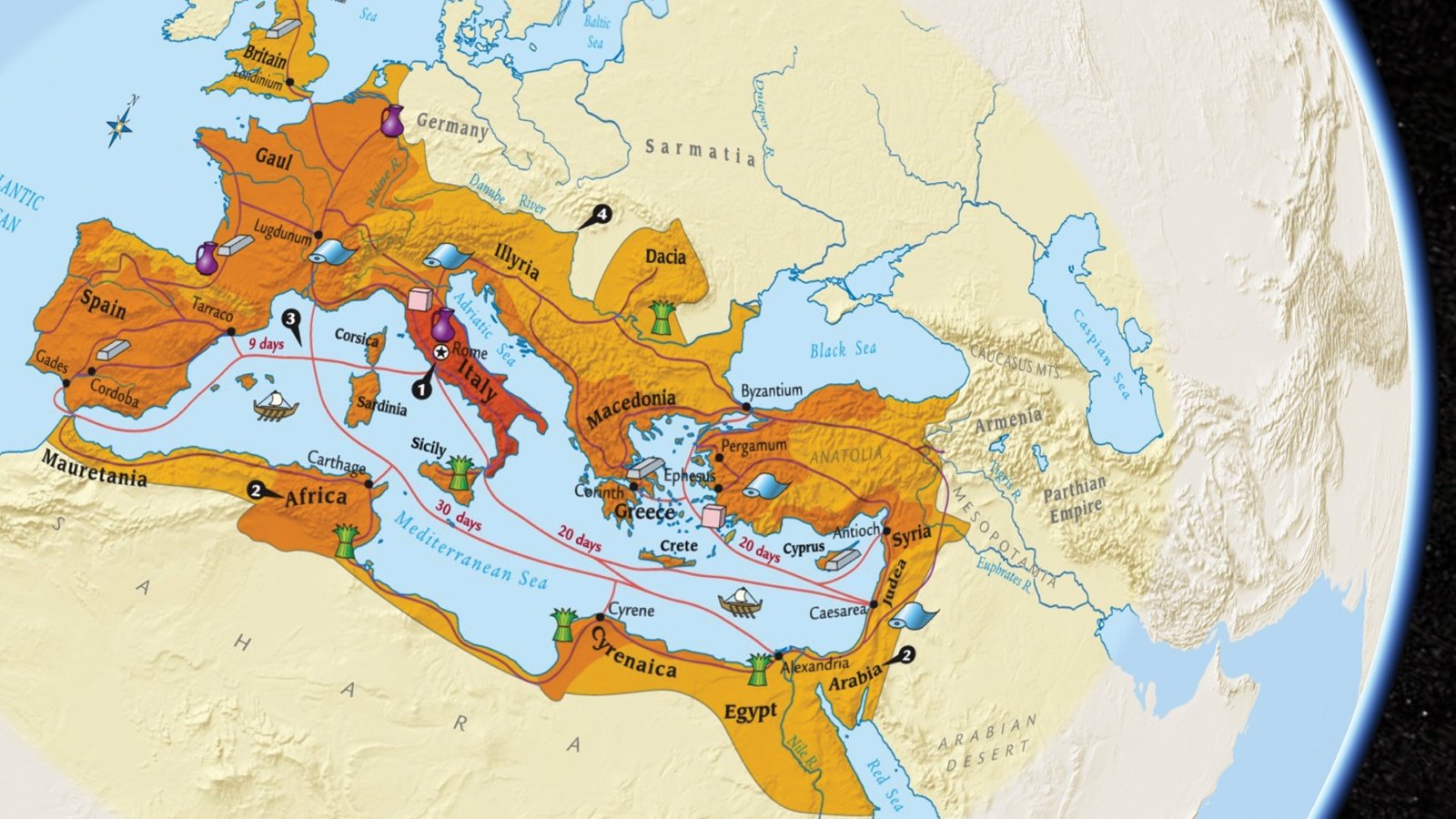
“It is no coincidence that, on all four sides, in all four corners, the borders of the Roman Empire stopped where wine could no longer be made.” ― Neel Burton, psychiatrist, philosopher, writer, and wine-lover
This might not be the best quote to share with children. Or is it? What we too often forget is to personalize history. According to Tom Standage’s A History of the World in 6 Glasses, we cannot understand ancient Rome without understanding all aspects of wine from production, a staple of commerce, and consumption. Wine was a vital staple to Roman culture and commerce, it defined the empire in art, history, humor, theology, economics, and more.
Explore mapping activities in Active Classroom with a free, 30-day trial
Could the backbone of the Roman Empire have also limited Rome’s expansion and lead to its demise? Was Roman expansion truly limited by the geographical access to wine? By focusing on geography, we can help students question historical causation of events. Students can delve deeper than memorization, and into a fuller embrace of history’s retelling of the human story.
Themes of Geography
According to the Guidelines for Geographic Education (1984), the five themes of geography are location, place, relationships within places (human/environmental interaction), relationships between places (spatial interaction or movement), and regions (their form and change). Breaking these separate themes into a coherent whole, we see that geography frames the historical narrative that encompasses all of human thought, emotion, and insight.
To begin with, geography helps students understand location and place. Too often this fundamental step gets passed over too quickly when teachers try to help students understand historical concepts. Just as a basic understanding of math is critical to fully understanding algebra, students need to understand the lay of the land before they can even start a discussion of human interaction.
Another way to approach basic place and location is to ask causation questions or “what if” questions. In other words, instead of teaching memorization of place names, time could be better spent asking how changing the Euphrates River’s direction would have affected the development of agriculture. Or, how the development of Pangea closed off the Indian subcontinent, thereby enabling a separate culture and religion to flourish. This shift advances the conversation from memorization to application and synthesizing new concepts.
‘
Mapping out an understanding of human relationships
Finally, discussions of geography lead directly and most importantly to human relationships. For example, any discussion of trade or migration is fully dependent on an understanding of mapping in historical and current contexts. One of the catalysts of the modern Syrian civil war is the effect of climate change devastating farmland. This has led to one of the largest diasporas in world history. Without an understanding of geography, we cannot fully understand the causal effects which ripple through the world’s reaction to this moment in time. Comparing Columbus’s maps with the locations of the indigenous people in the Dominican Republic can lead to a very revealing discussion of how one values a land and region.
How do you use mapping to elicit insights to historical concepts? We would love to hear from you.
Learn how you can get other meaningful geography lessons to share in the classroom
Try a free 30-day trial of Nystrom World
Ken Klieman is the author of Building an Empathy-Based Classroom, and has taught over 5,500 students and trained over 3,000 teachers. Ken has been awarded both California Teacher of the Year and Comcast All-Star Teacher of the Year. His work as a leading teacher trainer for the NEA and CTA and keynote speaker have solidified his pedagogical approach focusing on community building through performance-based, student-inquiry projects.
