
MAPPING UNITED STATES HISTORY
Mapping United States History combines richly illustrated atlases, markable activity maps, and ready-to-use lessons to make history active, visual, and collaborative. Students gather evidence from maps, text, and visuals; plot information on activity maps; analyze historical and geographic relationships; and synthesize conclusions while strengthening geographic literacy and critical thinking.
Components
- 30 copies of the Nystrom Atlas of United States History
- 1 Teacher’s Guide
- 15 markable activity maps
- 15 markers
Teacher’s Guide
Provides flexible, ready-to-teach, 15–30-minute skill-based activities and literacy lessons that develop historical understanding, geographic literacy, critical thinking, evidence-based reasoning, and literacy skills.
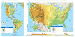
Markable Activity Map
Designed for collaborative, hands-on learning, the markable activity map helps students plot historical information, interpret geographic evidence, identify patterns and relationships, and draw evidence-based conclusions.
This title is part of the series: MAPPING UNITED STATES HISTORY
| Copyright | 2026 |
|---|---|
| Publisher | Nystrom Education |
| Grade | 6–12 |
| ISBN | 9780782508352 |